
Pantai Teluk Marina topographic map
Interactive map
Click on the map to display elevation.
About this map
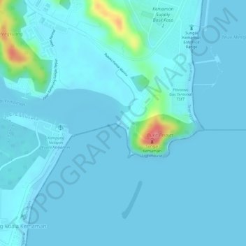
Name: Pantai Teluk Marina topographic map, elevation, terrain.
Average elevation: 9 m
Minimum elevation: 0 m
Maximum elevation: 88 m
Other topographic maps
Click on a map to view its topography, its elevation and its terrain.
Waterfront Kemaman
Malaysia > Terengganu > Chukai
Waterfront Kemaman, Chukai, Kemaman District, Terengganu, Malaysia
Average elevation: 8 m