
Westminister topographic map
Interactive map
Click on the map to display elevation.
About this map
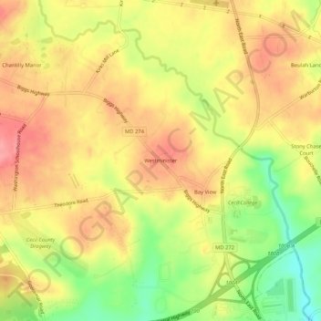
Name: Westminister topographic map, elevation, terrain.
Location: Westminister, Cecil County, Maryland, 21901, United States (39.62733 -75.98856 39.66733 -75.94856)
Average elevation: 99 m
Minimum elevation: 43 m
Maximum elevation: 137 m
Other topographic maps
Click on a map to view its topography, its elevation and its terrain.