
Longmoor topographic map
Interactive map
Click on the map to display elevation.
About this map
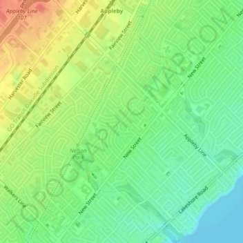
Name: Longmoor topographic map, elevation, terrain.
Average elevation: 95 m
Minimum elevation: 73 m
Maximum elevation: 123 m
Other topographic maps
Click on a map to view its topography, its elevation and its terrain.
Niagara Escarpment
Canada > Ontario > Burlington
Niagara Escarpment, Wetland Trail, Tyandaga, Nelson, Burlington, Halton Region, Ontario, L0R 2H7, Canada
Average elevation: 216 m