
Rogla topographic map
Interactive map
Click on the map to display elevation.
Rogla
The village of Rogla is located on the west slope of Mount Rogla, with which it shares its name. Rogla was attested in written sources in 1763–87 as Vitenska Planina and Wittenska Planina. The Slovene name Rogla is derived from the Slovene common noun roglja 'forked tree-covered mountain ridge', referring to the local topography.
About this map
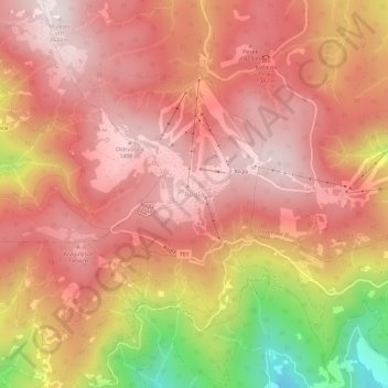
Name: Rogla topographic map, elevation, terrain.
Location: Rogla, Zreče, Slovenia (46.43321 15.31319 46.47321 15.35319)
Average elevation: 1,322 m
Minimum elevation: 877 m
Maximum elevation: 1,527 m