
Darkut topographic map
Interactive map
Click on the map to display elevation.
About this map
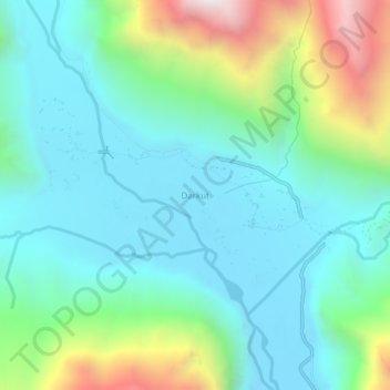
Name: Darkut topographic map, elevation, terrain.
Location: Darkut, Gilgit District, Gilgit-Baltistan, Pakistan (36.62569 73.41533 36.66569 73.45533)
Average elevation: 2,993 m
Minimum elevation: 2,642 m
Maximum elevation: 4,048 m