
Summerfield topographic map
Interactive map
Click on the map to display elevation.
About this map
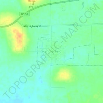
Name: Summerfield topographic map, elevation, terrain.
Location: Summerfield, Saint Clair County, Illinois, United States (38.59347 -89.75667 38.60090 -89.73370)
Average elevation: 149 m
Minimum elevation: 137 m
Maximum elevation: 170 m
Other topographic maps
Click on a map to view its topography, its elevation and its terrain.