
Glaise topographic map
Interactive map
Click on the map to display elevation.
About this map
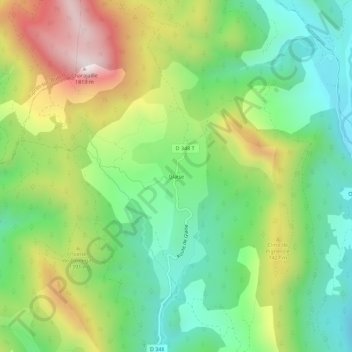
Name: Glaise topographic map, elevation, terrain.
Average elevation: 1,245 m
Minimum elevation: 922 m
Maximum elevation: 1,778 m
Other topographic maps
Click on a map to view its topography, its elevation and its terrain.
Oriol
France > Provence-Alpes-Côte d'Azur > Hautes-Alpes > Veynes > Oriol
Oriol, Veynes, Gap, Hautes-Alpes, Provence-Alpes-Côte d'Azur, France métropolitaine, 05400, France
Average elevation: 1,091 m