
Groningen topographic map
Interactive map
Click on the map to display elevation.
About this map
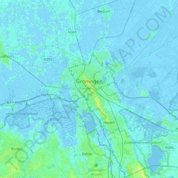
Name: Groningen topographic map, elevation, terrain.
Location: Groningen, Netherlands, The Netherlands (53.10620 6.46275 53.31296 6.77253)
Average elevation: 1 m
Minimum elevation: -8 m
Maximum elevation: 12 m