
Hammamet topographic map
Interactive map
Click on the map to display elevation.
About this map
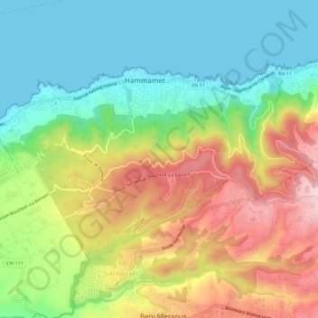
Name: Hammamet topographic map, elevation, terrain.
Location: Hammamet, Cheraga District, Algiers, 16060, Algeria (36.78888 2.94476 36.81619 3.00134)
Average elevation: 134 m
Minimum elevation: 0 m
Maximum elevation: 335 m