
Wynnewood topographic map
Interactive map
Click on the map to display elevation.
About this map
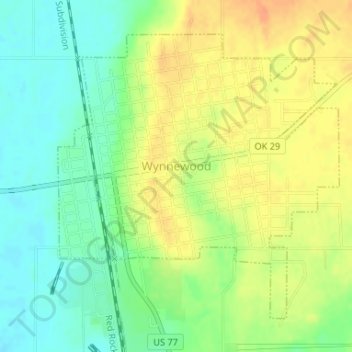
Name: Wynnewood topographic map, elevation, terrain.
Location: Wynnewood, Oklahoma, 73098, United States of America (34.63167 -97.17549 34.65353 -97.14925)
Average elevation: 271 m
Minimum elevation: 252 m
Maximum elevation: 290 m