
Scottsville topographic map
Interactive map
Click on the map to display elevation.
About this map
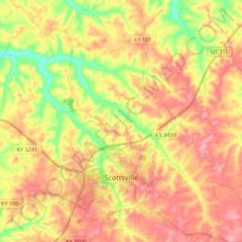
Name: Scottsville topographic map, elevation, terrain.
Location: Scottsville, Allen County, Kentucky, United States (36.72601 -86.31838 36.83636 -86.16849)
Average elevation: 221 m
Minimum elevation: 158 m
Maximum elevation: 269 m
Other topographic maps
Click on a map to view its topography, its elevation and its terrain.
Scottsville
United States > Kentucky > Allen County > Scottsville > Scottsville
Scottsville, Allen County, Kentucky, 42164, United States
Average elevation: 228 m