
Seefeld in Tirol topographic map
Interactive map
Click on the map to display elevation.
About this map
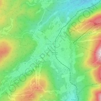
Name: Seefeld in Tirol topographic map, elevation, terrain.
Location: Seefeld in Tirol, Bezirk Innsbruck-Land, Tyrol, 6100, Austria (47.30892 11.16672 47.34892 11.20672)
Average elevation: 1,274 m
Minimum elevation: 1,050 m
Maximum elevation: 1,652 m