
Aarschot topographic map
Interactive map
Click on the map to display elevation.
About this map
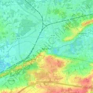
Name: Aarschot topographic map, elevation, terrain.
Location: Aarschot, Leuven, Flemish Brabant, Flanders, Belgium (50.95810 4.80040 51.01310 4.87061)
Average elevation: 26 m
Minimum elevation: 4 m
Maximum elevation: 70 m