
Slatina topographic map
Interactive map
Click on the map to display elevation.
About this map
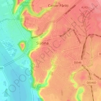
Name: Slatina topographic map, elevation, terrain.
Location: Slatina, Olt, Romania (44.40488 24.33653 44.44826 24.39931)
Average elevation: 152 m
Minimum elevation: 104 m
Maximum elevation: 187 m
Other topographic maps
Click on a map to view its topography, its elevation and its terrain.