
Aranguren topographic map
Interactive map
Click on the map to display elevation.
About this map
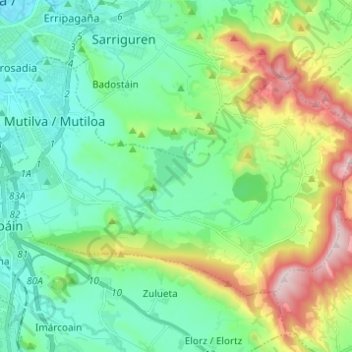
Name: Aranguren topographic map, elevation, terrain.
Location: Aranguren, Metropolialdea / Área Metropolitana, Navarre, Spain (42.74480 -1.63359 42.80598 -1.51075)
Average elevation: 544 m
Minimum elevation: 415 m
Maximum elevation: 881 m