
Forest Grove topographic map
Interactive map
Click on the map to display elevation.
About this map
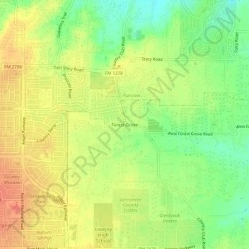
Name: Forest Grove topographic map, elevation, terrain.
Location: Forest Grove, Collin County, Texas, 75002, United States (33.10012 -96.62916 33.14012 -96.58916)
Average elevation: 188 m
Minimum elevation: 162 m
Maximum elevation: 208 m