
Saxton topographic map
Interactive map
Click on the map to display elevation.
About this map
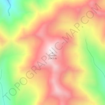
Name: Saxton topographic map, elevation, terrain.
Location: Saxton, Marlborough, New Zealand (-41.97441 173.14967 -41.97431 173.14977)
Average elevation: 1,664 m
Minimum elevation: 1,163 m
Maximum elevation: 2,036 m
Other topographic maps
Click on a map to view its topography, its elevation and its terrain.
Blumine Island / Ōruawairua
Blumine Island / Ōruawairua, Marlborough, New Zealand
Average elevation: 37 m
Robin Hood Bay
Robin Hood Bay, Marlborough, New Zealand
Average elevation: 78 m
Barometer
Barometer, Marlborough, 7240, New Zealand
Average elevation: 1,397 m
Devils Staircase
Devils Staircase, Marlborough, New Zealand
Average elevation: 372 m
Tapuae-o-Uenuku
Tapuae-o-Uenuku, Marlborough, New Zealand
Average elevation: 2,302 m
Wairau Valley
New Zealand > Marlborough > Wairau Valley
Wairau Valley, Marlborough, New Zealand
Average elevation: 185 m