
Le Vigan topographic map
Interactive map
Click on the map to display elevation.
About this map
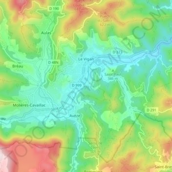
Name: Le Vigan topographic map, elevation, terrain.
Location: Le Vigan, Gard, Occitania, Metropolitan France, 30120, France (43.95510 3.59180 44.00846 3.67520)
Average elevation: 395 m
Minimum elevation: 197 m
Maximum elevation: 802 m