
Monte Tabor topographic map
Interactive map
Click on the map to display elevation.
About this map
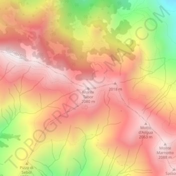
Name: Monte Tabor topographic map, elevation, terrain.
Location: Monte Tabor, San Bartolomeo Val Cavargna, Como, Lombardy, Italy (46.11221 9.18490 46.11231 9.18500)
Average elevation: 1,739 m
Minimum elevation: 1,110 m
Maximum elevation: 2,113 m