
Oakthorpe topographic map
Interactive map
Click on the map to display elevation.
About this map
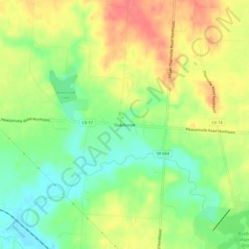
Name: Oakthorpe topographic map, elevation, terrain.
Location: Oakthorpe, Fairfield County, Ohio, 43150, United States (39.78562 -82.45599 39.82562 -82.41599)
Average elevation: 291 m
Minimum elevation: 261 m
Maximum elevation: 322 m