
Ejer topographic map
Interactive map
Click on the map to display elevation.
About this map
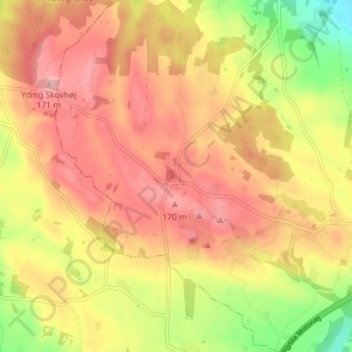
Name: Ejer topographic map, elevation, terrain.
Location: Ejer, Skanderborg Municipality, Central Denmark Region, Denmark (55.96202 9.80174 56.00202 9.84174)
Average elevation: 123 m
Minimum elevation: 38 m
Maximum elevation: 180 m