
Galbally topographic map
Interactive map
Click on the map to display elevation.
About this map
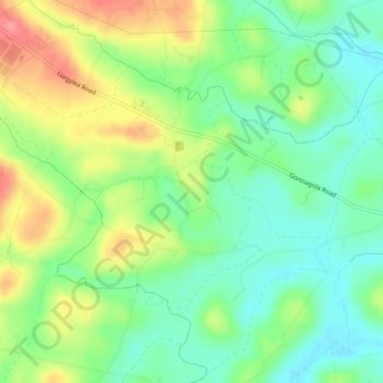
Name: Galbally topographic map, elevation, terrain.
Average elevation: 119 m
Minimum elevation: 86 m
Maximum elevation: 168 m
County Tyrone trails, hiking, mountain biking, running and outdoor activities
Other topographic maps
Click on a map to view its topography, its elevation and its terrain.
Castlecaufield
United Kingdom > Northern Ireland > County Tyrone > Castlecaulfield
Average elevation: 95 m