
Creswell topographic map
Interactive map
Click on the map to display elevation.
About this map
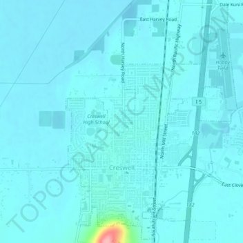
Name: Creswell topographic map, elevation, terrain.
Location: Creswell, Lane County, Oregon, 97426, United States (43.90906 -123.03409 43.93799 -122.99256)
Average elevation: 165 m
Minimum elevation: 155 m
Maximum elevation: 277 m
Other topographic maps
Click on a map to view its topography, its elevation and its terrain.
Thurston Hills Natural Area
United States > Oregon > Lane County > Springfield
Average elevation: 324 m