
Jijel topographic map
Interactive map
Click on the map to display elevation.
About this map
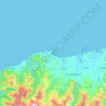
Name: Jijel topographic map, elevation, terrain.
Location: Jijel, Jijel District, Jijel, 18000, Algeria (36.65673 5.61149 36.97673 5.93149)
Average elevation: 141 m
Minimum elevation: -2 m
Maximum elevation: 1,306 m