
Setif topographic map
Interactive map
Click on the map to display elevation.
About this map
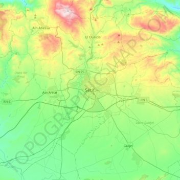
Name: Setif topographic map, elevation, terrain.
Location: Setif, Setif District, Setif, 19000, Algeria (36.02928 5.24349 36.34928 5.56349)
Average elevation: 1,058 m
Minimum elevation: 772 m
Maximum elevation: 1,733 m