
Petřín topographic map
Interactive map
Click on the map to display elevation.
About this map
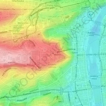
Name: Petřín topographic map, elevation, terrain.
Average elevation: 253 m
Minimum elevation: 177 m
Maximum elevation: 359 m
Other topographic maps
Click on a map to view its topography, its elevation and its terrain.
Prague Castle
Czech Republic > Prague > Prague
Prague Castle, Tomášská, Lesser Town, Prague, okres Hlavní město Praha, Hlavní město Praha, Prague, 11801, Czech Republic
Average elevation: 244 m
Kolovraty
Czech Republic > Prague > Prague
Kolovraty, Prague, okres Hlavní město Praha, Hlavní město Praha, Prague, 10300, Czech Republic
Average elevation: 317 m
Letňany
Czech Republic > Prague > Prague
Letňany, Prague, okres Hlavní město Praha, Hlavní město Praha, Prague, Czech Republic
Average elevation: 273 m