
Table Rock topographic map
Interactive map
Click on the map to display elevation.
About this map
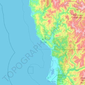
Name: Table Rock topographic map, elevation, terrain.
Average elevation: 242 m
Minimum elevation: -3 m
Maximum elevation: 1,410 m
Other topographic maps
Click on a map to view its topography, its elevation and its terrain.
Brookings
United States > Oregon > Brookings > Brookings
Brookings, Curry County, Oregon, 97415, United States
Average elevation: 131 m