
Hitachi Seaside Park topographic map
Interactive map
Click on the map to display elevation.
About this map
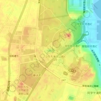
Name: Hitachi Seaside Park topographic map, elevation, terrain.
Location: Hitachi Seaside Park, Hitachinaka, Ibaraki Prefecture, Japan (36.39309 140.58950 36.41172 140.61152)
Average elevation: 27 m
Minimum elevation: -1 m
Maximum elevation: 40 m