
Pleasant Lake topographic map
Interactive map
Click on the map to display elevation.
About this map
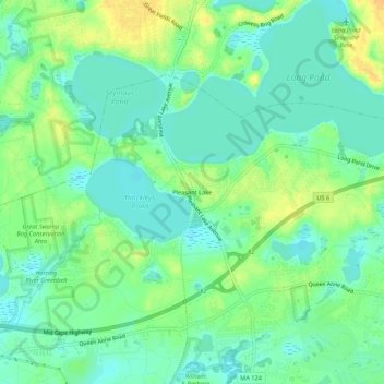
Name: Pleasant Lake topographic map, elevation, terrain.
Average elevation: 17 m
Minimum elevation: 5 m
Maximum elevation: 34 m
Other topographic maps
Click on a map to view its topography, its elevation and its terrain.
Harwich
United States > Massachusetts > Barnstable County > Harwich
Harwich, Barnstable County, Massachusetts, United States
Average elevation: 7 m