
Dytiki Soufla topographic map
Interactive map
Click on the map to display elevation.
About this map
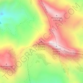
Name: Dytiki Soufla topographic map, elevation, terrain.
Average elevation: 1,893 m
Minimum elevation: 1,416 m
Maximum elevation: 2,313 m
Other topographic maps
Click on a map to view its topography, its elevation and its terrain.
Mornos Artificial Lake
Greece > Thessaly and Central Greece > Regional Unit of Phocis > Municipal Unit of Vardousia
Mornos Artificial Lake, Municipal Unit of Vardousia, Dorida Municipality, Regional Unit of Phocis, Central Greece, Thessaly and Central Greece, Greece
Average elevation: 672 m