
Kings Hill topographic map
Interactive map
Click on the map to display elevation.
About this map
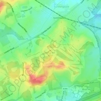
Name: Kings Hill topographic map, elevation, terrain.
Average elevation: 66 m
Minimum elevation: 43 m
Maximum elevation: 99 m
Other topographic maps
Click on a map to view its topography, its elevation and its terrain.
Burrowhill
United Kingdom > England > Surrey Heath > Burrowhill
Burrowhill, Chobham, Surrey Heath, Surrey, South East, England, GU24 8RQ, United Kingdom
Average elevation: 41 m
Crawley Hill
United Kingdom > England > Surrey Heath
Crawley Hill, Surrey Heath, Surrey, South East, England, GU15 2HF, United Kingdom
Average elevation: 91 m