
Wellington topographic map
Interactive map
Click on the map to display elevation.
About this map
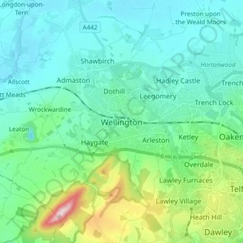
Name: Wellington topographic map, elevation, terrain.
Average elevation: 117 m
Minimum elevation: 47 m
Maximum elevation: 402 m
Other topographic maps
Click on a map to view its topography, its elevation and its terrain.
Wellington
United Kingdom > England > Wellington
Wellington, Somerset, South West England, England, TA21 8LR, United Kingdom
Average elevation: 103 m