
Sainte-Julie topographic map
Interactive map
Click on the map to display elevation.
About this map
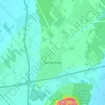
Name: Sainte-Julie topographic map, elevation, terrain.
Average elevation: 37 m
Minimum elevation: 15 m
Maximum elevation: 198 m
Other topographic maps
Click on a map to view its topography, its elevation and its terrain.
Contrecœur
Canada > Québec > Marguerite-D'Youville
Contrecœur, Marguerite-D'Youville, Montérégie, Québec, J0L 1C0, Canada
Average elevation: 17 m
Verchères
Canada > Québec > Marguerite-D'Youville
Verchères, Marguerite-D'Youville, Montérégie, Québec, J0L 2R0, Canada
Average elevation: 19 m
Saint-Amable
Canada > Québec > Marguerite-D'Youville > Saint-Amable
Saint-Amable, Marguerite-D'Youville, Montérégie, Québec, J0L 1N0, Canada
Average elevation: 42 m