
Little Falls topographic map
Interactive map
Click on the map to display elevation.
About this map
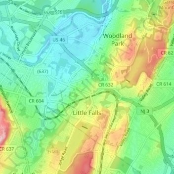
Name: Little Falls topographic map, elevation, terrain.
Location: Little Falls, Passaic County, New Jersey, USA (40.85948 -74.25448 40.89264 -74.19069)
Average elevation: 90 m
Minimum elevation: 37 m
Maximum elevation: 194 m