
Ubachsberg topographic map
Interactive map
Click on the map to display elevation.
About this map
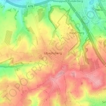
Name: Ubachsberg topographic map, elevation, terrain.
Location: Ubachsberg, Voerendaal, Limburg, Netherlands, 6367, Netherlands (50.83404 5.92835 50.87404 5.96835)
Average elevation: 164 m
Minimum elevation: 97 m
Maximum elevation: 217 m