
Emmen topographic map
Interactive map
Click on the map to display elevation.
About this map
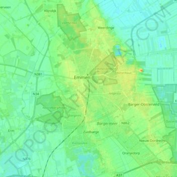
Name: Emmen topographic map, elevation, terrain.
Location: Emmen, Drenthe, Netherlands (52.72560 6.83085 52.83790 6.97947)
Average elevation: 19 m
Minimum elevation: 9 m
Maximum elevation: 41 m
Other topographic maps
Click on a map to view its topography, its elevation and its terrain.
Zuidbarge
Netherlands > Drenthe > Emmen
Zuidbarge, Emmen, Drenthe, Netherlands, 7825 TS, Netherlands
Average elevation: 20 m