
Saba topographic map
Interactive map
Click on the map to display elevation.
About this map
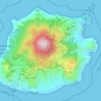
Name: Saba topographic map, elevation, terrain.
Location: Saba, Caribbean Netherlands, Netherlands (17.61426 -63.25847 17.65027 -63.21472)
Average elevation: 165 m
Minimum elevation: -1 m
Maximum elevation: 847 m