
Baarn topographic map
Interactive map
Click on the map to display elevation.
About this map
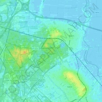
Name: Baarn topographic map, elevation, terrain.
Location: Baarn, Utrecht, Netherlands (52.16762 5.21649 52.23283 5.33581)
Average elevation: 5 m
Minimum elevation: -3 m
Maximum elevation: 27 m
Other topographic maps
Click on a map to view its topography, its elevation and its terrain.
Eembrugge
Netherlands > Utrecht > Baarn
Eembrugge, Baarn, Utrecht, Netherlands, 3741 LB, Netherlands
Average elevation: 1 m