
Telok Bahang Forest Park topographic map
Interactive map
Click on the map to display elevation.
About this map
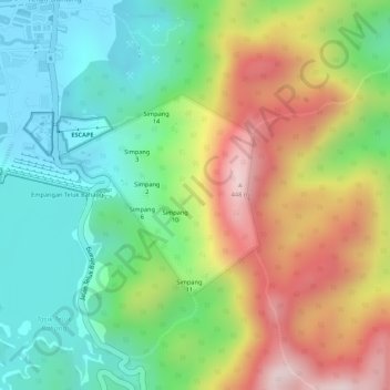
Name: Telok Bahang Forest Park topographic map, elevation, terrain.
Average elevation: 184 m
Minimum elevation: 8 m
Maximum elevation: 429 m
Other topographic maps
Click on a map to view its topography, its elevation and its terrain.
Pantai Aceh
Malaysia > Penang > Pantai Aceh
Pantai Aceh, Barat Daya, Penang, 11050, Malaysia
Average elevation: 73 m