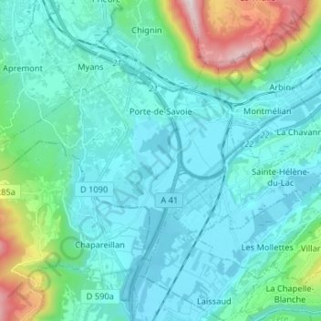
Porte-de-Savoie topographic map
Interactive map
Click on the map to display elevation.
About this map
Name: Porte-de-Savoie topographic map, elevation, terrain.
Average elevation: 415 m
Minimum elevation: 246 m
Maximum elevation: 1,270 m

Click on the map to display elevation.
Name: Porte-de-Savoie topographic map, elevation, terrain.
Average elevation: 415 m
Minimum elevation: 246 m
Maximum elevation: 1,270 m