
Mandya topographic map
Interactive map
Click on the map to display elevation.
About this map
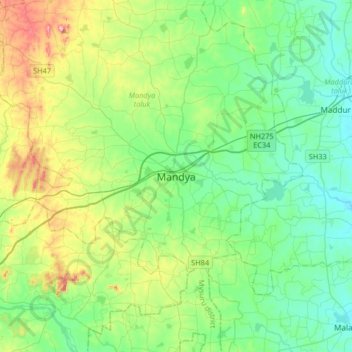
Name: Mandya topographic map, elevation, terrain.
Average elevation: 693 m
Minimum elevation: 615 m
Maximum elevation: 916 m
Mandya is located at 12°31′N 76°54′E / 12.52°N 76.9°E / 12.52; 76.9. It has an average elevation of 678 metres (2,224 ft).
Other topographic maps
Click on a map to view its topography, its elevation and its terrain.
Basaralu
India > Karnataka > Mandya taluk
Basaralu, Mandya taluk, Mandya district, Karnataka, 571416, India
Average elevation: 755 m