
Anshun topographic map
Interactive map
Click on the map to display elevation.
About this map
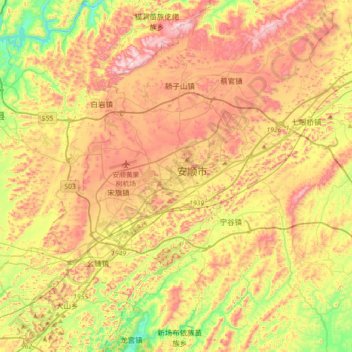
Name: Anshun topographic map, elevation, terrain.
Location: Anshun, Xixiu, Anshun, Guizhou, 561000, China (26.09491 105.78378 26.41491 106.10378)
Average elevation: 1,375 m
Minimum elevation: 1,088 m
Maximum elevation: 1,658 m
Anshun's administrative area spans latitude 25° 21'−26° 38' N and longitude 105° 13'−106° 34' E and contains sizeable areas of karst formation. It borders Guiyang, the provincial capital, and Qiannan Buyei and Miao Autonomous Prefecture to the east, Liupanshui to the west, Qianxinan Buyei and Miao Autonomous Prefecture to the south, and Bijie to the north. Within the prefecture, the elevation ranges from 1,102 to 1,694 metres (3,615 to 5,558 ft).