Geolocate

Bahrain Bay topographic map

Interactive map

Click on the map to display elevation.

About this map

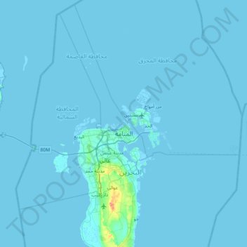
Name: Bahrain Bay topographic map, elevation, terrain.

Location: Bahrain Bay, Manama, Capital Governorate, 346, Bahrain (25.92808 50.26082 26.56808 50.90082)

Average elevation: 2 m

Minimum elevation: -2 m

Maximum elevation: 123 m

Other topographic maps

Click on a map to view its topography, its elevation and its terrain.

Nabih Saleh

Bahrain > Capital Governorate > Manama

Nabih Saleh, Manama, Capital Governorate, 604, Bahrain

Average elevation: 2 m

حديقة سترة الكبرى

Bahrain > Capital Governorate > Manama

حديقة سترة الكبرى, Manama, Capital Governorate, 604, Bahrain

Average elevation: 3 m