
Franklin Park topographic map
Interactive map
Click on the map to display elevation.
About this map
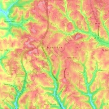
Name: Franklin Park topographic map, elevation, terrain.
Location: Franklin Park, Allegheny County, Pennsylvania, 2573, USA (40.54065 -80.15932 40.61630 -80.06398)
Average elevation: 351 m
Minimum elevation: 265 m
Maximum elevation: 405 m