
Waubach topographic map
Interactive map
Click on the map to display elevation.
About this map
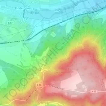
Name: Waubach topographic map, elevation, terrain.
Average elevation: 262 m
Minimum elevation: 147 m
Maximum elevation: 419 m
Other topographic maps
Click on a map to view its topography, its elevation and its terrain.
Waubach
Deutschland > Rheinland-Pfalz > Kinderbeuern
Waubach, Kinderbeuern, Traben-Trarbach, Landkreis Bernkastel-Wittlich, Rheinland-Pfalz, 54539, Deutschland
Average elevation: 267 m