
Achenkirch topographic map
Interactive map
Click on the map to display elevation.
About this map
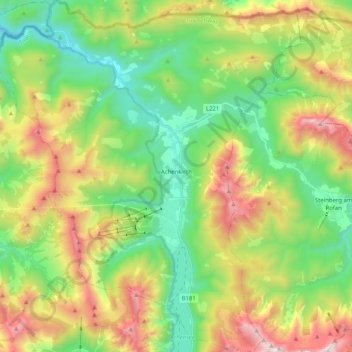
Name: Achenkirch topographic map, elevation, terrain.
Location: Achenkirch, Schwaz, Tyrol, 6215, Austria (47.45730 11.60065 47.59456 11.77762)
Average elevation: 1,332 m
Minimum elevation: 790 m
Maximum elevation: 2,268 m