
島後 topographic map
Interactive map
Click on the map to display elevation.
About this map
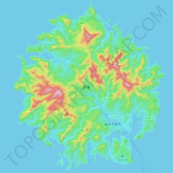
Name: 島後 topographic map, elevation, terrain.
Location: 島後, Okinoshima, 隠岐郡, Préfecture de Shimane, Chūgoku, Japon (36.15973 133.17653 36.34892 133.38599)
Average elevation: 80 m
Minimum elevation: -2 m
Maximum elevation: 568 m