
Stourton topographic map
Interactive map
Click on the map to display elevation.
About this map
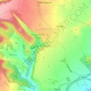
Name: Stourton topographic map, elevation, terrain.
Average elevation: 174 m
Minimum elevation: 112 m
Maximum elevation: 249 m
Other topographic maps
Click on a map to view its topography, its elevation and its terrain.
Gasper
United Kingdom > England > Stourton > Gasper
Gasper, Stourton with Gasper, Stourton, Wiltshire, South West England, England, BA12 6, United Kingdom
Average elevation: 173 m