
Torrente topographic map
Interactive map
Click on the map to display elevation.
About this map
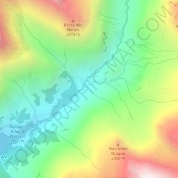
Name: Torrente topographic map, elevation, terrain.
Location: Torrente, Bionaz, Aosta Valley, Italy (45.92615 7.54762 45.92699 7.54934)
Average elevation: 2,448 m
Minimum elevation: 1,954 m
Maximum elevation: 3,254 m
Other topographic maps
Click on a map to view its topography, its elevation and its terrain.
Dent d'Hérens
Italy > Aosta Valley > Bionaz
Dent d'Hérens, Bionaz, Aosta Valley, Italy
Average elevation: 3,354 m