
Taourirt topographic map
Interactive map
Click on the map to display elevation.
About this map
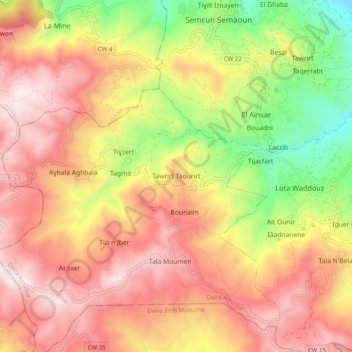
Name: Taourirt topographic map, elevation, terrain.
Location: Taourirt, Amizour District, Bejaia, 06082, Algeria (36.53288 4.77043 36.61288 4.85043)
Average elevation: 688 m
Minimum elevation: 117 m
Maximum elevation: 1,135 m